Large Scale Detailed Mapping of Dengue Vector Breeding Sites using Object Recognition with Google Street View Images
|
|
Kittipop, Benyarut, Thansuda, Poom, Siripong, Peter Haddawy
Faculty of ICT, Mahidol University
|
Motivation
|
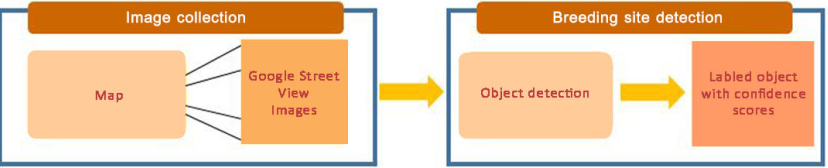
Software Pipeline
|
-
390 milliion cases world wide
-
No curative treatment
-
Vaccine not sufficiently effective
-
Environmental management essential for control
-
Breeding sites too small to detect by remote sensing
-
Manual surveys do not scale
|
  |
|
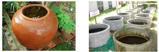
Common breeding sites in Thailand
|
- High priority to low priority
- Big jar
- Cement pond
- Bucket
- Old tire
- Trash can
|
  |
|
 |
Network Training
|
 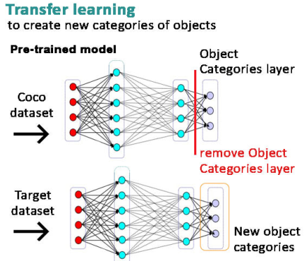 |
The output layer, representing the original object layer categories is removed and the lower layers, representing features are retained. A new output layer is created that represents the new object classes to be learned. The resulting network is trained with examples of the new classes. The feature layers enable learning from examples than would be otherwise necessary. |
|
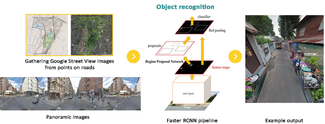
Image Collection and Breeding Site Detection
|
 |
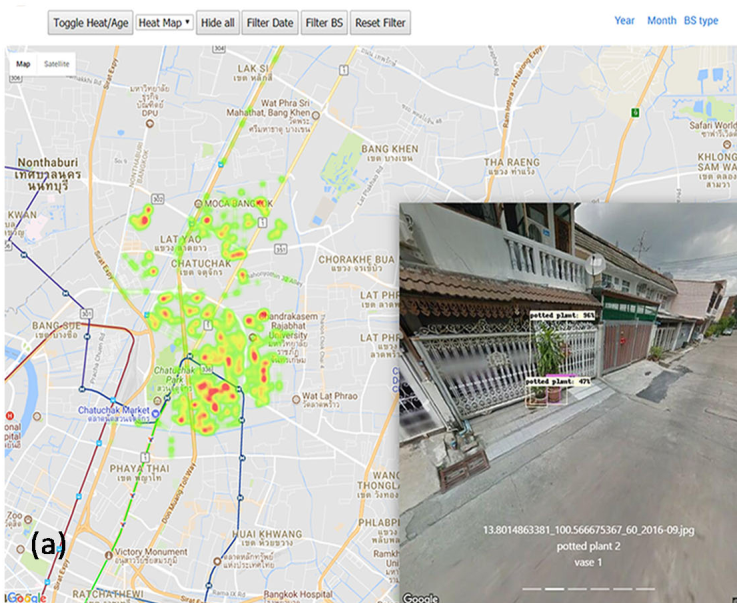
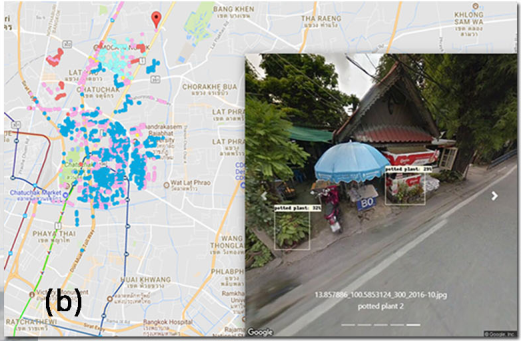
Data Visualization
|
|

Decision Support tool assists in identifying high risk areas and in targeting intervention.
(a) Heat map shows density of breeding sites
(b) Age map shows dates of images.
-Filters allow the user to select area, dates, and types of breeding sites.
|
|
Ongoing work
|
- Design street view index
- Determine correlation with House index, Container Index, Breautau Index, and dengue cases
|